
This adventure begins with travel day 3, April 20th. This is my favorite part of the cross-country drive. Coming out of Pocatello in full view of the snow-topped Rocky Mountains all the way to Soda Springs, ID. A quick stop at the local gas and snack store and then turn left on ID 34.
The highway passes some mining/industry but mostly lush grasslands, a large recreational lake, a couple of ranches, a wide place or 2 in the road with “town” names and small groves of Aspen trees. This picture is from 2 years ago taken in the fall.

There are definitely bright colors in the fall, but this relatively deserted area is beautiful any time. The snow-capped peaks are visible all the way.

Heading North out of Soda Springs, ID on ID 34 after about 20 miles, the road turns east entering the Caribou National Forest. This canyon follows the Tincup Creek down in elevation into Freedom and then onto Alpine, WY.

While there is a campground and some hiking and fishing and a ranch or two along the way, it is mostly pristine wilderness with a nicely paved road that usually only locals travel. You will not encounter much traffic. The scenery is some of the most beautiful anywhere. The 15 ft snow posts along side the road, though, tell the tale of treacherous winter driving.

Drive slowly and enjoy the beauty, peace and near solitude as it goes, but also so you can watch for deer that are often crossing the road. Stop and get out now and then and take in the air and snap some photos.

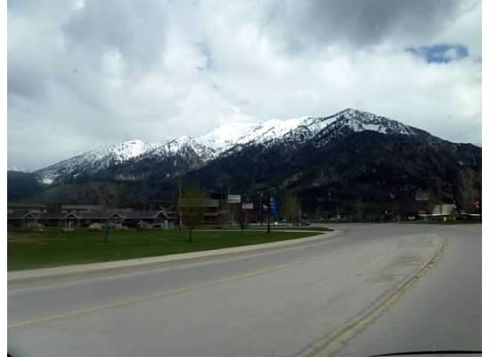
Reluctantly the bottom of the canyon appears and the road opens up on ranch land and open prairie with the Rocky Mountains in view approaching Freedom.

Reaching the north/south junction at Freedom, turn south for a short distance (there are signs) and then east again toward the mountains until coming to WY 89 and turn left (North) to travel on into Alpine.
Ah, but you are now high up in Rockies and after a brief stop at Alpine (be sure to take in the fresh mountain air) it’s a right turn (east) to follow the beautiful Snake River Valley through the mountains down in elevation to Hoback.
Snake River
Hoback
At Hoback, take a right and head South to Pinedale with mountain views all the way. Again, slow down, enjoy the majestic scenery of the Rocky Mountains and watch out for deer.


Gorgeous scenery. I remember flying near those snow capped peaks on my flight to Spokane in April on my way to the paddle wheel cruise down the Snake-Columbia River. Really nice! Your pictures were wonderful. Thanks so much. Marg
On Sun, May 29, 2016 at 5:26 PM, Adventures along the Umpqua River and the Oreg
LikeLike
So glad you enjoyed it, Marg. It’s my favorite part of the trip!
LikeLike